
Fajl:Kurdish Areas Sorani.png

Nav dijə kardej pamjə: 800 × 483 piksel. Čo iznon: 320 × 193 piksel | 640 × 387 piksel | 1,024 × 618 piksel | 1,280 × 773 piksel | 3,000 × 1,812 piksel.
Ce fajli original (3,000 × 1,812 пиксел, фајли памјә: 915 KB, MIME тиспир: image/png)
Xylosə
| Təsvir |
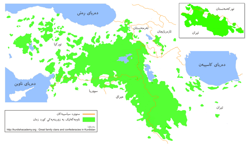
English: Kurdish Areas (Kurdistan). Original source: Kurdish Institute of Paris Map by Mehrdad Izady.
Kurdî: ناوچە کوردنشینەکان (کوردستان)
فارسی: مناطق کردنشین (کردستان) |
| Taryx | |
| Mənbə | Cymy əməle |
| Myəllif | Ferhad y |
Lisensijə
| I, the copyright holder of this work, release this work into the public domain. This applies worldwide. In some countries this may not be legally possible; if so: I grant anyone the right to use this work for any purpose, without any conditions, unless such conditions are required by law. |
Fajli tarix
Fajli syftə varianti vinde bə taryx/vaxti egətən.
| Tarix/Vaxt | Gədəlijə šikil | Pamjəjon | Ištirokəkə | Komment | |
|---|---|---|---|---|---|
| ysətnə | 09:50, 20 Avgust 2009 | | 3,000 × 1,812 (915 KB) | Ferhad y | {{Information |Description={{en|1=Kurdish Areas (Kurdistan)}} {{ku|1=ناوچە کوردنشینەکان (کوردستان)}} {{fa|1=مناطق کردنشین (کردستان)}} |Source=Own work by uploader |Author=Ferhad y |Date=2009/08 |
Fajli oko doj
səhifə oko dojdən ym fajl:
Fajli umumi oko doj
Ym fajl oko doə bejdə by vikijonədə:
- Oko doə bejdə ckb.wikipedia.org
- Oko doə bejdə diq.wikipedia.org
- Oko doə bejdə en.wikipedia.org
- User:KureCewlik81
- User:Hectorian
- User:Vindheim
- User:Ozgurgerilla
- User:WikiMart~enwiki
- User:Soapyyy
- User:Navdar
- User:D.Kurdistani
- User:Makalp
- User talk:Baristarim
- User talk:Bogdangiusca/Archive12
- User:Alanmustafa
- Wikipedia:WikiProject Kurdistan
- Template:User WikiProject Kurdistan
- Wikipedia:WikiProject Kurdistan/Assessment
- User:Asoyrun
- User talk:Aivazovsky/Archive 3
- User:Kermanshahi
- User:Bulgu
- User talk:Biruitorul/Archive2
- User:Bohater
- Wikipedia:WikiProject Kurdistan/Participants
- Wikipedia:WikiProject Kurdistan/Templates
- Wikipedia:WikiProject Kurdistan/User Box
- Template:WPKU-Member
- Template:WPKU-Invite
- Portal:Kurdistan/New articles announcements
- Wikipedia:WikiProject Kurdistan/Outreach
- Wikipedia:WikiProject Kurdistan/Sidebar
- User:Bohater/Userboxes
- Wikipedia:WikiProject Kurdistan/Information/Intro
- Category:Mid-importance Kurdistan articles
- Category:High-importance Kurdistan articles
- Category:Low-importance Kurdistan articles
- Category:Top-importance Kurdistan articles
- User:Sahmeditor/My userboxes
- User:Waterfall999
- User:Nawroz 21 3
- User:Gurgin
- User talk:Chaldean/Archive4
- User:Flavallee
- User:Emadd
- User:Gbeebani
- User:Kurdish Empire
- User:Marmzok
- User:Metino84
- User:Serchia
- User:Rob984
Dijə karde končo umumi oko dojdən ym fajli.