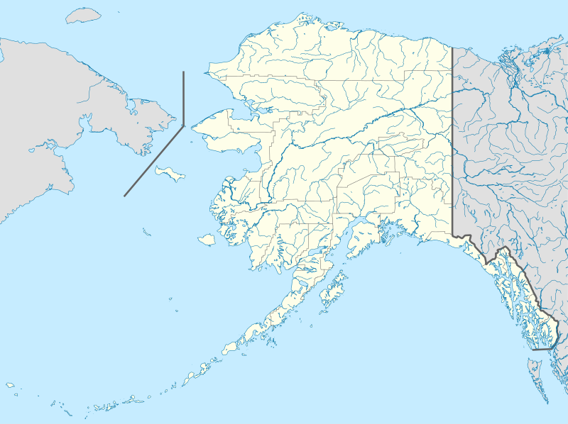
Fajl:USA Alaska location map.svg

Size of this PNG preview of this SVG file: 800 × 598 piksel. Čo iznon: 320 × 239 piksel | 640 × 478 piksel | 1,024 × 765 piksel | 1,280 × 956 piksel | 2,560 × 1,912 piksel | 1,553 × 1,160 piksel.
Ce fajli original (SVG фајл, номинәләдә 1,553 × 1,160 пиксел, фајли памјә: 1.24 MB)
Fajli tarix
Fajli syftə varianti vinde bə taryx/vaxti egətən.
| Tarix/Vaxt | Gədəlijə šikil | Pamjəjon | Ištirokəkə | Komment | |
|---|---|---|---|---|---|
| ysətnə | 23:13, 3 Oktjabr 2009 |  | 1,553 × 1,160 (1.24 MB) | Alexrk2 | Linien gesäubert |
| 23:03, 3 Oktjabr 2009 |  | 1,553 × 1,160 (1.25 MB) | Alexrk2 | Westlicher Teil korrigiert | |
| 22:35, 3 Oktjabr 2009 |  | 1,553 × 1,160 (1.24 MB) | Alexrk2 | == Beschreibung == {{Information |Description= {{de|Positionskarte von Alaska, USA}} Quadratische Plattkarte, N-S-Streckung 210.0 %. Geographische Begrenzung der Karte: * N: 72.0° N * S: 51.0° N * W: 188.0° W * O: 129.0° W { |
Fajli oko doj
52 səhifon oko dojdən ym fajl:
- Ambler
- Anvik
- Baklend
- Breviq Mişn
- Dedhors
- Delta Cankşın
- Dirinq
- Elim
- Ferbanks
- Fols Pass
- Fort Yukon
- Holi Kros
- Husliya
- Hyus
- Hyuston(Alyaska)
- Kinq Kouv
- Kobuk
- Kodiak
- Kold Bey
- Kollec
- Koyuk
- Koyukuk
- Makqrat
- Nelson Laqun
- Nikolayevsk
- Nort Poul
- Nulato
- Nyuheylen
- Pajlot Pojnt
- Palmer
- Pitersberq
- Port Heyden
- Qambell
- Qolovin
- Qreylinq
- Savunqa
- Selavik
- Sent Pol
- Sivard
- Soldotna
- Stebbins
- Teller
- Uanaklit
- Unalaska
- Valdes
- Vasilla
- Vayt Maunteyn
- Veyls
- Vranqel
- Şaktulik
- Şanqnak
- Şaqeluk
Fajli umumi oko doj
Ym fajl oko doə bejdə by vikijonədə:
- Oko doə bejdə af.wikipedia.org
- Oko doə bejdə als.wikipedia.org
- Oko doə bejdə an.wikipedia.org
- Oko doə bejdə ar.wikipedia.org
- Oko doə bejdə ast.wikipedia.org
- Alaska
- Baranof
- Juneau (Alaska)
- Anchorage (Alaska)
- Fairbanks (Alaska)
- Ninilchik (Alaska)
- Islles Aleutianes
- Kodiak (Alaska)
- Golfu d'Alaska
- Monte Denali
- Parque y Reserva Nacionales de les Puertes del Árticu
- Cordal d'Alaska
- Módulu:Mapa de llocalización/datos/Alaska
- Módulu:Mapa de llocalización/datos/Alaska/usu
- Aeropuertu Internacional Ted Stevens Anchorage
- Base de la Fuercia Aérea Eielson
- Islla Semisopochnoi
- St. George (Alaska)
- Islles Pribilof
- St. Paul (Alaska)
- Islla Sitkinak
- Islla Tugidak
- Oko doə bejdə azb.wikipedia.org
Dijə karde končo umumi oko dojdən ym fajli.


